|
Be in touch while travelling!
|
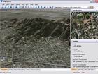
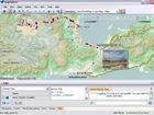
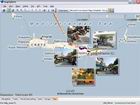
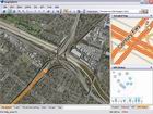
About MapSphereMapSphere is a mapping software for Windows that:
|
Now on iPad!Try MapSphere Trip & Photo Viewer, which gives the convenient access to MapSphere trip photos on your iPad.New app MapSphere GPS Logger for recording GPS track. GPS Track EditorTry our brand new GPS Track Editor for Windows - a tool to view, analyze, and edit GPS tracks.News
July 24, 2012
High resolution photos in MapSphereHigh resolution images are now supported by MapSphere! »
June 09, 2012
MapSphere GPS Logger for iPadNow you can record GPS track with your iPad and easily upload it to your trip. »
June 06, 2012
GPS Track EditorWe are pleased to announce our brand new application: GPS Track Editor. » |
| Copyright © 2003-2026 MapSphere | Terms of Use Privacy Policy |


